Great Redwood Trail Master Plan FAQ
Project Description
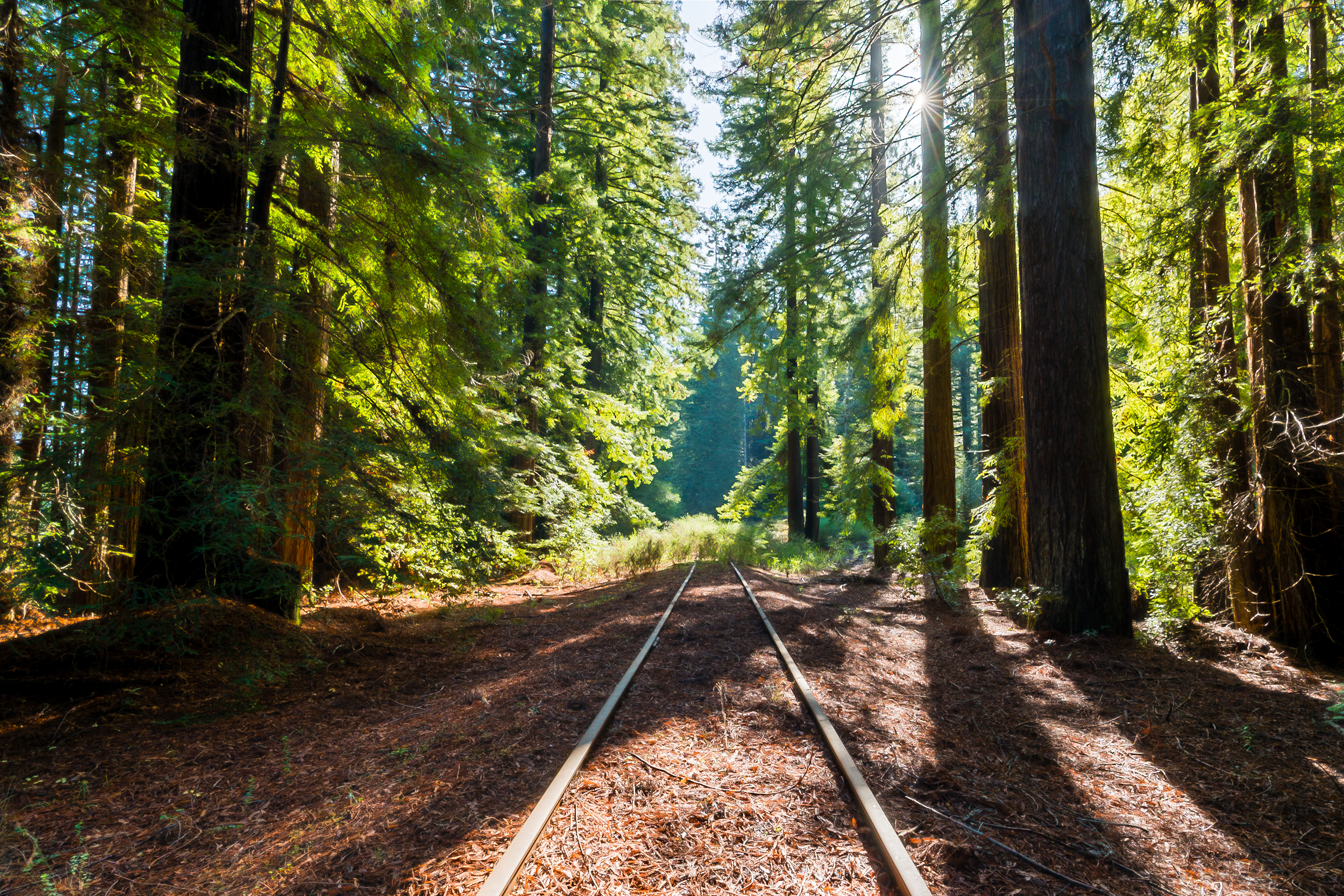
The Great Redwood Trail (GRT) will be a 316-mile rail-trail project connecting California’s San Francisco and Humboldt Bays. Once completed, it will be the longest rail-trail in the United States and will travel through scenic landscapes including old-growth redwood forests, alongside oak woodlands and vineyards, and through the dramatic Eel River Canyon. The GRT will connect the many vibrant communities of Humboldt, Trinity, Mendocino, Sonoma, and Marin counties, creating a transformational economic engine and boosting healthy recreation for all in the North Coast region.
The Master Plan will be a roadmap for planning, constructing, and managing the Great Redwood Trail. The Master Plan will be informed by robust community engagement to capture community desires, concerns, and ideas. The Master Plan will serve as a guiding document to address issues such as trail user experience, trail design, operations and maintenance, habitat restoration, project priorities, funding, and management of the trail. The Master Plan covers Mendocino, Trinity, and Humboldt counties; the Great Redwood Trail in Sonoma and Marin Counties will be planned and constructed by SMART.
Within Mendocino, Trinity, and Humboldt counties, the Great Redwood Trail will be a 231-mile multi-use trail. The trail will follow the abandoned North Coast Rail Authority (NCRA) rail line and right-of-way, which is near the Russian River and Hwy 101 from Cloverdale to Willits, and the Eel River watershed from Covelo to Humboldt Bay.
Visit the interactive map to explore the trail alignment: https://greatredwoodtrailplan.org/
The Great Redwood Trail will connect Larkspur Landing in Marin County north to Cloverdale in Sonoma County, following the US 101 corridor. From Cloverdale, the trail will travel through Ukiah and Willits in Mendocino County, and Rio Dell, Fortuna, Eureka, Arcata and Blue Lake in Humboldt County. The trail will pass through smaller “trail towns” as well, including Hopland, Calpella, Redwood Valley, Dos Rios, Alderpoint, Scotia, Loleta, and Manila.
The California State Coastal Conservancy (Coastal Conservancy) is leading the Master Plan effort, in partnership with the Great Redwood Trail Agency (GRTA). The GRTA is a local agency established by the Great Redwood Trail Agency Act to oversee the trail development of the former North Coast Railroad Authority rail corridor in Mendocino, Trinity, and Humboldt counties. The Coastal Conservancy is a state governmental agency that partners with communities to preserve, protect, restore and improve public access to the California coast. The Master Plan is being supported by a consultant team led by Alta.
On September 30, 2021, Governor Newsom signed into law Senate Bill 69 – the Great Redwood Trail Agency Act. This bill reorganized the North Coast Rail Authority (NCRA) into the Great Redwood Trail Agency (GRTA) and established GRTA’s new mission of developing the Great Redwood Trail. SB 69 also appropriated $10.3 million to the Coastal Conservancy to fund the Great Redwood Trail Master Plan and provide interim staffing to support the newly established GRTA.
The Master Plan will be developed between 2022 and 2024, with robust community engagement throughout the entire length of the future trail. There are four aspects of this engagement:
- Listen and Learn. The purpose is to gather information from the community and agencies, to learn about preferences, priorities, opportunities, and concerns regarding the trail.
- Build Consensus. The Project Team will develop draft recommendations for the Great Redwood Trail for community feedback.
- Refine Recommendations. The Project Team will revise the trail recommendations to incorporate community, stakeholder, and agency feedback.
- Review. The Project Team will develop final recommendations for the Great Redwood Trail for public review. While this will be final engagement for the formal Master Planning process, there will be ongoing opportunities to provide feedback to inform future trail projects coming out of the Master Plan.
Design & Use
The Great Redwood Trail will create a transformational economic engine. The immense scale and scenic beauty of the completed trail will create new recreational experiences that become a destination for all of California and beyond. The benefits of the trail will expand into the communities along the corridor that support trail users with services. The mutual relationship between the Great Redwood Trail and the trail towns along it can create sustained economic benefits for generations.
As part of the Master Plan, an Economic Benefit Analysis was completed for the proposed trail in Humboldt, Trinity, and Mendocino Counties. In total, the fully completed trail and associated impacts are estimated to generate over $100,000,000 in annual benefits. These benefits include:
- Recreation, tourism, and retail benefits from visitor spending on lodging, goods, and services.
- Transportation benefits of fewer vehicular miles traveled, including lower roadway maintenance costs and increased individual savings.
- Health benefits from expanded recreation opportunities and associated reduction in health care costs.
From Willits north to Humboldt Bay, the rail corridor has been “railbanked,” allowing the Great Redwood Trail to be built as a rail-to-trail, where the trail will be located within the historic rail alignment. The right of way will be maintained in an unbroken fashion to protect the long-term status of the trail under federal law. From Willits south to the Sonoma County border, the interaction between the railroad and the trail is still being determined. The Great Redwood Trail in Sonoma and Marin County will be rail-with-trail operated by SMART. To learn more about GRTA railbanking efforts, visit our webpage at: https://thegreatredwoodtrail.org/railbanking/
The Great Redwood Trail will be a multi-use trail with sections open to walking, biking, equestrians, and other means of mobility, as well as opportunities for long-distance hiking, cycling, and riding. The types of allowed trail uses will vary by section depending on the environment and community input during the Master Planning process, among other factors.
The Great Redwood Trail will have a variety of trail surface types over its 231 miles, including paved multi-use, crushed-stone multi-use, and backcountry natural earth. Paved multi-use trails consist of concrete or asphalt and will be located near cities, towns, and areas with high use, while backcountry trails are constructed using natural earth material and will be located in the most rural sections of the trail, including the Eel River Canyon. The extent and locations proposed for each trail surface type will be included in the Master Planning process and will be informed by community input.
Sections of the Great Redwood Trail will be accessible, including certain access points and amenities. The opportunities for accessible trail sections will be identified as part of the Master Planning process and informed by community input, and in compliance with any applicable law.
Amenities along the trail may include trailheads, parking, restrooms, water access, kayak launches, campgrounds, seating, viewpoints, public art, and more. Opportunities and ideas for trail amenities will be identified as part of the Master Planning process and informed by community input.
Operations & Maintenance
The Great Redwood Trail will be managed and maintained by a variety of regional and local public agencies and recreation-oriented non-profits. Specific agencies and the length of trail each will manage and maintain will be identified as part of the Master Planning process.
Adjacent property owners’ desires for privacy and protection along the Great Redwood Trail will vary by landowner and land use. The project team will work with adjacent landowners to understand their concerns and, as applicable, identify practical design solutions for the trail corridor as part of the Master Planning process. Specific design solutions for each trail section will not be determined until after the Master Plan is completed and the trail section reaches the Design Phase.
If you are a private landowner along the planned Great Redwood Trail alignment, we want to hear from you. Contact us directly using the contact form at https://greatredwoodtrailplan.org/ or leave a voicemail at (707) 440-9445.
The Master Plan will identify trail design features, policies, and operations to address personal safety and security issues. The Project Team will coordinate with local law enforcement and fire departments to inform safety and emergency procedures. Some ideas currently include law enforcement patrols, emergency call boxes, fencing, and other access control features.
The Master Plan will include trail design guidelines that incorporate best practices for minimizing fire risks. The Project Team will coordinate with local fire departments to inform fire safety along the trail. The Master Plan will also identify opportunities for the Great Redwood Trail to serve as a potential fire break and/or assist firefighters in accessing fire prone wilderness areas.
The Master Plan will include a comprehensive strategy that outlines the legal and practical tools available to prevent or minimize camping in undesignated locations. Collaborating with housing and social service agencies to address this issue has been successful on this and other rail-trails trails in California. “Lessons learned” will be included in design guidelines and the Great Redwood Trail’s operations and maintenance plan.
Timeline & Implementation
The Master Plan will identify funding sources to support development of new trail segments, along with funding options for maintenance of existing and future trail segments. Examples of funding sources include but are not limited to Caltrans’ Active Transportation Program, Caltrans’ Sustainable Communities Planning Grants, and Coastal Conservancy partner grants.
Though the Great Redwood Trail is a long-term project, portions of the trail already exist and can be used today. This includes Ukiah Rail-Trail, Eureka Waterfront Trail, Humboldt Bay Trail, Arcata Rail-with-Trail, and Annie & Mary Trail. An additional 15 miles of trail is currently in the planning or construction stage, in Ukiah, Willits, Eel River Canyon, and Humboldt County. Future sections of the trail will be prioritized and funded for planning and construction as the Master Plan is completed and beyond.
A prioritization process will rank the order and priority for constructing the Great Redwood Trail, segment by segment. This trail prioritization will be informed by community and agency priorities, anticipated trail demand, and the feasibility and cost of each section. The full trail prioritization process will be developed as part of the Master Plan.
Engagement & Communications
There will be opportunities for virtual and in-person participation throughout the Master Plan process and beyond. Please visit https://greatredwoodtrailplan.org/ read the Draft Master Plan, use the interactive map to share local knowledge, subscribe to our mailing list, and track upcoming virtual and in-person events. Volunteer opportunities to help maintain existing trail can be found on this website as well.
You can provide input on the General Great Redwood Trail project through a number of virtual or in-person engagement opportunities, outlined in the “How can I support this project?” FAQ. To share more specific concerns, please contact us directly using the contact form at https://greatredwoodtrailplan.org/ or leave a voicemail at (707) 440-9445.